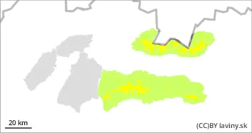
During the last snowfall period, 30 - 60 cm of new snow was added in our mountains. However, no new snow has been added in the last 4 days. The situation is gradually stabilising. The danger is concentrated in places where there are hard blown slabs. Smooth grassy slopes and very steep slopes above 35° are particularly dangerous. There is still powder snow in the north and in shady locations. Below the upper forest line and at lower altitudes there is significantly less snow, so the situation is more stable there.
Snowpack
The snow cover consists in places of a layer of hard blown snow under which is a softer layer of felted snow. This was formed in a period when it snowed without wind influence. It is between these two layers that there was a large difference in hardness and therefore an interface along which avalanches can be triggered. In the north, in shady locations and where there was less wind influence, the snow is powdery. The total snow depth in our mountains is 10-120 cm.
Tendency
without significant change.
PK
Danger level
treeline
Avalanche Problem
Wind slab
Treeline
Watch out for places with blowing snow.
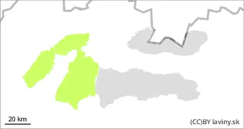
During the last snowfall period last week, 30 - 60 cm of new snow was added in our mountains. However, no new snow has been added in the last 4 days. The situation is gradually stabilising. The danger is concentrated in places where there are hard blown slabs. Smooth grassy slopes and very steep slopes above 35° are particularly dangerous.
Snowpack
There are two distinct layers in the snow cover. Old frozen snow forms the base. The second layer is the new snow from Wednesday. These layers are stabilising.